Drone: Applications and Uses In Agriculture
March 8, 2017, 1:06 pm
WHAT IS A DRONE?
According to the Oxford Advanced Learner’s Dictionary, Drone is the name given to a female bee or a worker bee. And if you don't know anything about the bee colony, worker bees are those bees that do a lot of work in the colony (gathering food, attending to the queen bee etc.) but do not reproduce.
However, in technological lingo, a drone is used to describe an unmanned aircraft or unmanned aerial vehicles (UAVs)—basically, flying robots. It is fitting that these flying robots be described or called drones because, like the worker bees, they are used to perform a lot of work and activities.
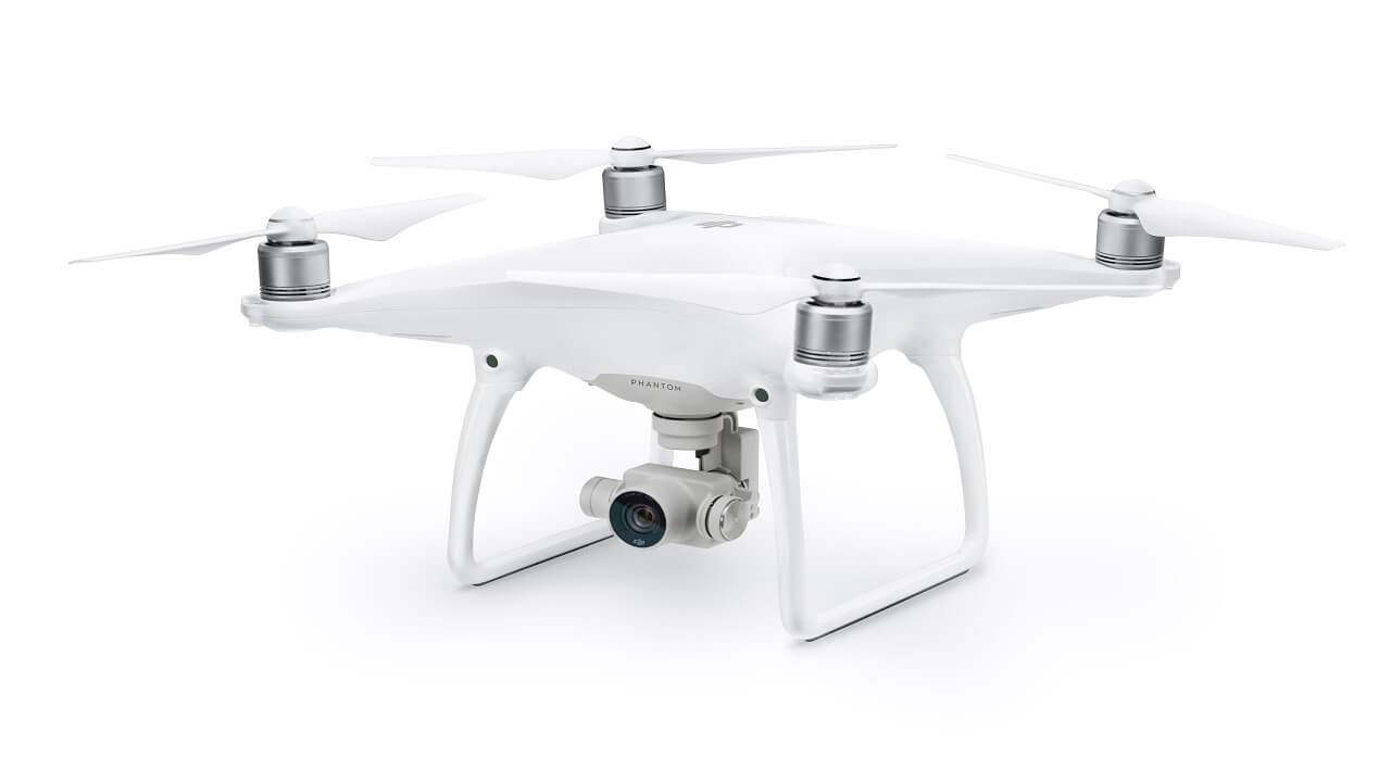
DRONE
Drones are small or medium-sized aircrafts that are remotely controlled or can fly autonomously through software-controlled flight plans in their systems working in conjunction with onboard sensors and GPS.
HISTORY OF DRONES
The first generally used drone was a full-size retooling of the de Havilland DH82B "Queen Bee" biplane, which was fitted out with a radio and servo-operated controls in the back seat. The plane could be conventionally piloted from the front seat, but, generally, the plane flew unmanned and was shot at by artillery gunners in training.
As the usual progression of technology goes, this military application of drones soon found use in civilian or non-military environments. One of such applications was the creation of small toy planes for children, in the early 1980s, which were flown by remote controllers on the ground. Since that time, many people and organizations began to catch on to the bigger picture of drone use.
For example, in 2007, Chris Anderson—NY Times best-selling author ( The Long Tail, Free and Makers) and at the time the editor-in-chief of Wired magazine—built his first drone at home with his children using parts from a Lego Mind Machine. Chris’ curiosity was sparked by this ‘experiment’ and his inquisitiveness led him to discover DIYDrones.com, which has since grown into the world’s largest open robotics development community.
Through that site Chris met Jordi Muñoz, a 19 year old college dropout & electronics wunderkind from Ensenada, Mexico, who, while bored to tears waiting for his green card to arrive, announced his genius to the DIY community by creating a fully-functioning autopilot using circuitry lifted from a Nintendo Wii remote.
The unlikely pair founded 3D Robotics. In late 2012, Chris Anderson, retired to dedicate himself to his drones company, 3D Robotics Inc. The company, which started off specializing in hobbyist personal drones, now markets its solutions to photography and film companies, construction, utilities and telecom businesses, and public safety companies, among others.
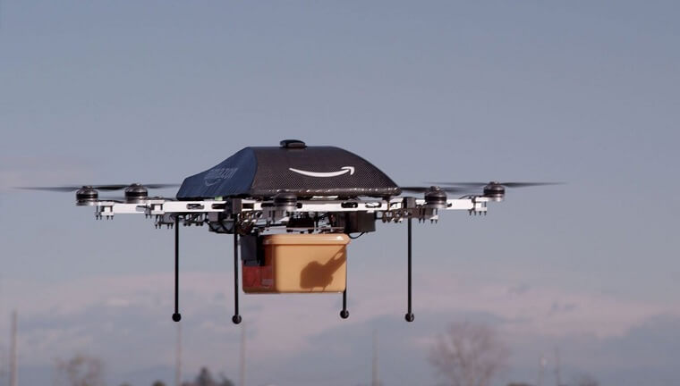
Some big organizations too started seeing the potential of commercial drone use. On December 1, 2013, Amazon CEO Jeff Bezos revealed plans for Amazon Prime Air to use Miniature Unmanned Air Vehicle (Miniature UAV), otherwise known as drone, technology to autonomously fly individual packages to customers’ doorsteps within 30 minutes of ordering. To qualify for 30 minute delivery, the order must be less than 5 pounds (2.26 kg), must be small enough to fit in the cargo box that the craft will carry, and must have a delivery location within a 10-mile radius of a participating Amazon order fulfillment center. 86% of packages sold by Amazon fit the weight qualification of the program.
On December 7, 2016, Amazon successfully delivered a Prime Air parcel to an actual customer in the Cambridge area of England. They have also built a Prime Air fulfillment center in the Cambridge area which will soon be opened to "dozens of customers", then "hundreds more in the future".
USES OF DRONES
Since coming into the mainstream, drones have found use in the following areas:
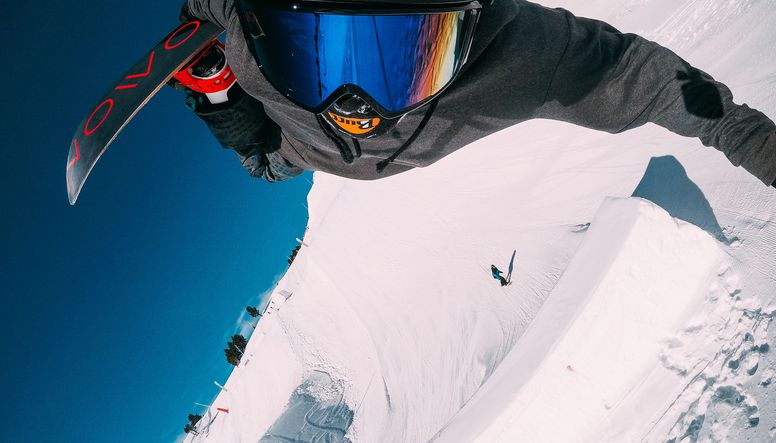
- Journalism, Filming and Aerial photography: With the rise and success of GoPro, drones are starting to be used in sports photography and cinematography. They were used in the 2014 Winter Olympics in Sochi for filming skiing and snowboarding events. Another group considering using drones is journalists. The ability to collect footage and information for use in live broadcast is a real possibility in the near future. Aerial photography for the Real estate market is becoming more popular also. Artists like Olamide, Phyno etc. have used drones to shoot their music videos
- Shipping/ Delivery: Drones can be used to deliver small packages, pizzas, letters, medicines, beverages etc. at short distances. Companies like Amazon, UPS and DHL see its potential for package deliveries.
- Law-Enforcement and border patrol: Drones help with crowd surveillance and public safety. They also help in monitoring criminal activity, crime scenes and fire investigations. The border patrol monitors criminal smugglers of migrants and drugs with Drones.
- Search and Rescue/ Healthcare: With thermal sensors, drones can quickly discover the location of lost persons, and are particularly useful at night or in challenging terrain. The search and rescue mission is a battle against time, particularly in harsh conditions, and drones become a powerful tool because of the ease of deployment. Besides locating victims, a Drone could potentially be used to “drop in supplies” to an otherwise unreachable location. For example a drone might be utilized to lower a walkie-talkie (portable 2-way radio), GPS locater, medical supplies or water to a stranded victim before rescue crews are able to extract them.
- Geographic Mapping: Drones can reach difficult-to-access locations like eroded coastline or mountaintops and acquire very high-resolution data to create 3D maps. The technology is already available to amateurs and professionals, enabling them to collect data and instantly download the imagery. Some are even using the collected data to contribute to crowd-sourced mapping applications like OpenStreetMap.
- Structural Safety Inspections: Drones can provide faster access to high-quality, real-time visual inspection for all types of utility companies that need to inspect power lines, oil and gas pipelines, transmission towers, buildings and bridges, wind turbines and rotor blades enabling the inspector or team to access the information from a safe position. The inspection of complex infrastructure will benefit from regular aerial monitoring. The ability to sense in three dimensions, take thermal readings, and to detect metal strain will greatly improve infrastructure inspection. Small Drones that can hover and get close will provide a new level of detail to improve performance.
- Disaster Management: After a natural or man-made disaster, a drone provides a quick means to gather information, navigate debris with a portable and useful technology that doesn’t drown out cries for help, and that can be deployed by teams that are working a specific area. Equipped with high definition cameras and radars, Drones can give rescuers access to a higher field of view without the need for wasting resources on manned helicopters. And, because of their small size, they can provide a close-up view of areas where larger aerial vehicles would prove perilous or inefficient.
- Wildlife Monitoring/Poaching: Poaching is a bigger problem than ever before, elephants, rhinos, and big cats are vanishing at a disturbing rate. The presence of drones has proven to serve as a deterrent to poachers and illegal loggers. They also monitor salmon, rabbits, seals, sea lions providing new insight into animal behavior. The devices have many advantages in this type of monitoring and research, including the ability to approach wildlife closely without spooking it, the ability to operate at night, and with thermal camera sensors, drones provide unprecedented protection.
- Construction Sites: The monitoring from above of construction project sites provides a new input during all phases of a project life cycle. Aerial photography is done now for only the largest projects, however the input would be used more widely and more frequently if more readily accessible. The ability to quickly model from above in 3D with increasing precision will provide an important way to check on projects, compare to plans, as well as better coordination of materials on the job site.
- Storm Tracking/Forecasting: Sending drones into hurricanes and tornadoes provides new insight into their behavior and trajectory. Unmanned systems are the best approach to these dangerous situations, and with specialized sensors to detail weather parameters, new insight becomes possible.
- Recreation: Plenty of hobbyists are picking up drones to play around with, both by flying remotely and by programming drone AI (artificial-intelligence). It can be used in many ways to capture videos and photographs. Such as the Dronie.
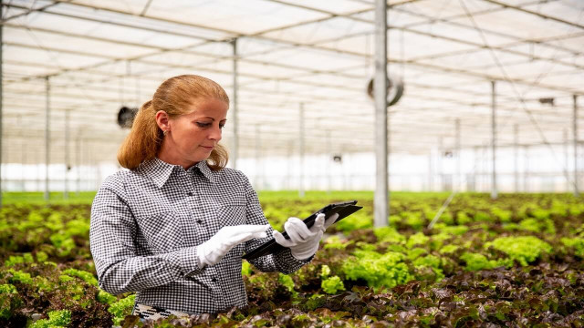
AGRICULTURE DRONES
Agricultural use of drones could comprise 80% of the market. Price Waterhouse Cooper estimates the market for drone-powered solutions in agriculture at $32.4 billion (while they expect that the global market for drones will balloon to $127 billion by 2020). This is because of the need to closely monitor crops to improve management and yield and the need to do this more regularly and cheaply.
Drone Applications and Uses in Agriculture
The following are the three major ways drones are being deployed in agriculture:
1. Crop Monitoring and Health Assessment
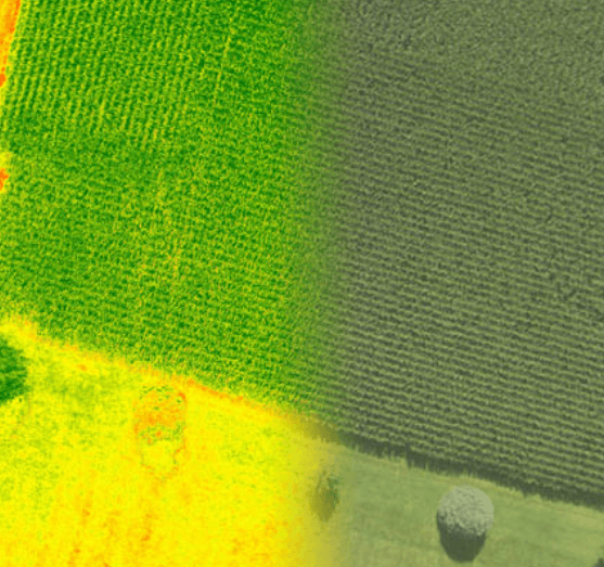
Drones can leverage existing technologies to improve crop farming. For instance, for over 40 years, agronomists and scientists have used Normalized Difference Vegetation Index (NDVI) to assess the health of crops and plants. NDVI was created when scientists learned that a plant’s unique reflection of a combination of visible red light and near-infrared (NIR) light gave a good indication of plant health — far superior to what the reflectance of visible light can reveal. NDVI is a single measure that characterizes this information. In precision agriculture, NDVI data provides growers with an accurate measurement of crop vigor and allows them to zero in on problem areas that may need further attention.
NDVI information is captured by NDVI sensor which processes wavelengths of light outside of those captured by regular RGB cameras, like you have on your cell phone. Advances in technology have allowed for integration of high-quality NDVI imagers onto drones and now companies like Sentera offers TrueNDVI™ sensors that integrate onto several of the most popular UAV platforms. Even the smallest consumer-grade drones with accurate NDVI sensors can rival any expensive remote-sensing platform. And when combined with sophisticated NDVI analytics, and comparative data from previous flights, significant progress can be made in crop planning, optimizing inputs and recognizing crop health issues before they become major problems.
2. Crop Spraying
Distance-measuring equipment—ultrasonic echoing and lasers such as those used in the light-detection and ranging, or LiDAR, method—enables a drone to adjust altitude as the topography and geography vary, and thus avoid collisions. Consequently, drones can scan the ground and spray the correct amount of liquid, modulating distance from the ground and spraying in real time for even coverage. This results in increased efficiency with a reduction of the amount of chemicals penetrating into groundwater. In fact, experts estimate that aerial spraying can be completed up to five times faster with drones than with traditional machinery.
3. Irrigation
Drones with hyperspectral, multispectral, or thermal sensors can identify which parts of a field are dry or need improvements. Additionally, once the crop is growing, drones allow the calculation of the vegetation index, which describes the relative density and health of the crop, and show the heat signature, the amount of energy or heat the crop emits.
REGULATIONS OF DRONES
The growth in commercial and personal drones has also created numerous safety concerns, namely midair collisions and loss of control. Privacy issues are also a growing concern with the spread of drone use.
Specific concerns about drones flying too close to commercial aircraft prompted calls for regulations which were answered in the U.S. by the Federal Aviation Administration (FAA). The FAA has implemented a set of unmanned aircraft rules placing limits on autonomous or semi-autonomous drone operation. Specifically, the FAA mandates, among other things:
- Unmanned aircraft must remain within visual line-of-sight (VLOS) of the remote pilot in command and the person manipulating the flight controls of the small UAS or, alternately, within VLOS of the visual observer
- Drones must at all times remain close enough to the remote pilot in command and the person manipulating the flight controls for those people to be capable of seeing the aircraft unaided by any device other than corrective lenses
- UAVs may not operate over anyone not directly participating in the operation, under a covered structure or inside a covered stationary vehicle
- Daylight-only operations, or civil twilight (30 minutes before official sunrise to 30 minutes after official sunset, local time) with appropriate anti-collision lighting
- Must yield right of way to other aircraft
The rise of commercial drones, its uses and applications, haven’t gone unnoticed in Nigeria too. The Nigerian Civil Aviation Authority (NCAA) has also released guidelines for civilian uses of drones. The guidelines for getting a drone for commercial use in Nigeria issued by the NCAA are:
- Application for grant of Permit for Aerial Aviation Services (PAAS) shall be made in writing to the Director General, Nigerian Civil Aviation Authority (NCAA)
- The application shall be signed by a person duly authorized by the applicant.
- The application shall be submitted to the Director General on or before a date not less than six (6) months to the expected date of utilization of the PAAS.
The application for the grant of PAAS must contain the following particulars:
- Name and address of applicant;
- Type(s) of air services to be provided;
- Proposed operational base of applicant;
- Details of proposed routes to be operated where applicable;
- Number and types of proposed aircraft to be utilized; and
- Time and frequency of the services.
Only registered companies are allowed to apply for the PAAS license and they will have to tender the following documents:
- Four (4) copies of certified true copy the Certificate of
- Four(4) copies of certified true copy of Memorandum and Articles of Association, Particulars of the company directors (one member of the board must be an aviation professional and majority shares must be held by Nigerians), Statement of Share Capital (minimum of twenty million naira share capital only)
- Four(4) copies of the current Tax Clearance Certificates of the company and of each of the Directors (Originals should also be submitted for sighting)
- Four(4) copies of detailed Business Plan of the operation
- Evidence of the applicant’s solvency to undertake the business
- Duly completed of application forms (forms are to be obtained)
- Duly completed Personal History Statement (PHS) forms and two (2) passport photographs in respect of each of the shareholders of the company having more than 5% equity shareholding (The PHS forms are to be completed at the Headquarters of the SSS in Abuja)
- Receipt of payment of non-refundable N500, 000 (five hundred thousand Naira) non-refundable processing fee.
After receiving your permit, it will be valid for 3 years and you’ll have to pay an annual utilization fee of N100, 000 (one hundred thousand naira) to the Aviation Authority. These guidelines are very demanding but there’s every indication that they will be relaxed as time goes on.
WHERE TO BUY DRONES
If you would like to purchase a drone for yourself, you can visit Ruko Drones to view a vast selection of drones.
Share This Article: