
Introduction to Geographical Information System
January 6, 2024, 12:21 pm
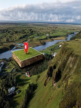
Geographical Information System (GIS) is a branch of engineering science that has revolutionized the way locations and points on the earth can be stored and analyzed.
Introduction to Geographical Information System
GIS offers many benefits and advantages to many sectors and industries, especially the agriculture and farming sectors
WHAT IS A GEOGRAPHIC INFORMATION SYSTEM (GIS)
Geographical Information System (GIS) is any automated system which captures, stores, retrieves, analyzes and displays spatial data.
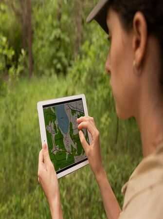
Geographic Information System (GIS) is designed to work with data referenced by spatial or geographic coordinates. Geographic information systems therefore are a group of software, hardware, and processes that are used for collecting, storing, and analyzing geographically referenced data. Then, this data will be presented through a computer-supported cartographic application, and mapping, a comprehensive tool for spatial analysis
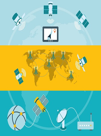
An additional definition of a geographic information system is a software program used for presenting, interpreting, and preparing the results that relate to the surface of the earth. This program will maintain the process, analysis, making, and display of the maps
GIS DATA MODELS
GIS operates on two conceptually different data models, Raster model and Vector model. These two models are based on different concepts with inherent advantages and disadvantages.
Vector GIS
In the vector model the location (spatial data) is represented by coordinate pairs, (x) and (y).
If we examine the world around us and think about how they could be represented on a map, we will probably arrive at the conclusion that real world objects in most cases could be represented by three different types of geometrical shapes:
1. Points are used for representing objects without any area extent such as wells, rainfall stations, drilling sites, etc. These objects can be regarded as 0-dimensional and their location is described with one pair of coordinates.
2. Lines are used for representing linear objects such as roads, rivers, telephone lines, etc. Linear objects are described by vectors, in the simplest form a line having a start and an end point. These points are referred to as nodes. More complex lines have start point, end point and a number of breakpoints in between that define a change in direction of the line. The more complex the shape of the linear feature, the more breakpoints are needed to describe its shape. Such breakpoint is often referred to as a vertex and the location is described by a coordinate pair for each vertex.
3. Polygons (areas) are used for representing areas such as land cover classes, soil classes, etc. The pair of coordinates for the line that defines the limit or border of the area are stored in the same way as for a line object, with the fundamental difference that the coordinates for the start and end nodes are the same (the line delimiting the area must make a complete closure of the area, hence the coordinates must be the same).
Vector data have no scale in this respect and the resolution of the geographic co-ordinates is basically determined by computer limitations for storing decimals and the accuracy and precision that was used to measure the x and y coordinates. In most applications the resolution can be considered as mathematically exact
Raster GIS
Raster format is when an area is divided into a grid containing a number of uniform grid cells. Each grid cell has a fixed size that decides the resolution of the information, a given position in the grid is expressed as geographic co-ordinates or row and column number, and a value telling which type of cell it is. This value may be of virtually any desired type, and is derived from the area the cell represents. It can be the arithmetic mean of revenue for the population in the area, the most important vegetation cover class or the mid-point elevation of the cell.
Satellite images and computer assisted classifications made from satellite images are examples of raster format data suitable to store in a GIS.
The simplest way data in a raster format file is stored is sequentially in a predetermined order in which the position in the grid can be identified for each cell. Each row in the raster data file may represent one row in the grid, or each cell can be stored on a new row in the data file, or the number of cell values stored on a row in the data file may be fixed to a certain number. The latter way of storing data is a common way to store digital satellite data.
Advantages and Disadvantages of Raster and Vector GIS
Raster GIS has the advantage of simple data structure, all kinds of spatial analysis and modelling fairly fast and easy. The representation of continuously changing surfaces is good. Simulation is easy due to the uniform grid size. Data is also easy to combine with remote sensing data, since both are in raster format. The available software is generally fairly cheap. The main disadvantages are large data volumes, fixed (and often low) resolution, projection transformations are difficult to perform, advanced topology is difficult to establish, and finally the output is less beautiful than drawn line maps.
Vector models have good representation of complex topology making queries on attribute easy, the geographic precision is higher, updating is easier, and output is compatible to hand drawn line maps.
Disadvantages of Vector GIS models are the complex data structure, overlaying and simulation is difficult to understand, spatial analysis and filtering within polygons are impossible, and the vector technology is more expensive, both regarding software and hardware.
GIS USES AND APPLICATIONS
GIS have been developed independently for a wide variety of purposes and the future of GIS will depend to a large extent on the degree to which these various needs can be integrated and met by one type of product. The growth of GIS in recent years has been led by developments in a number of areas and there have been distinct differences in the forms that development has taken and in the meaning attached to GIS. Some of the strategic uses of GIS are as follows:
Forestry
Forestry has been responsible for a significant growth in the use of GIS in the past five years. Ideally, GIS technology would be used for the updating and maintenance of a current forest inventory and for modeling and planning forest management activities such as cutting and silviculture, road construction, and watershed conservation. In other words, the true advantages of GIS accrue only when emphasis is placed on the manipulation, analysis, and modeling of spatial data in an information system. In practice GIS have often been used for little more than automation of the cartography of forest inventories, because of limitations in the functionality of software or resistance to GIS approaches on the part of forest managers
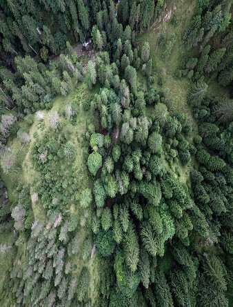
The earliest motivation for GIS in forestry was the ability to update the inventory on a continuous basis by topological overlay of records, reducing the average age of the inventory from the existing 10 years to a few weeks. More sophisticated uses include calculation of marketable timber, modeling outbreaks of fire, and supporting planting management decisions.
The typical Forest Service GIS will be used to manage road facilities, archaeological sites, wildlife habitats, and a host of other geographical features. The relative emphasis on each of these varies greatly from forest to forest.
Several factors account for the recent very rapid growth of GIS activity in the forest industry. First, effective forest management has been a significant societal concern and has attracted government funding.
Secondly, GIS technology is seen as an effective solution to the problem of maintaining a current resource inventory, since reports of recent bums, cutting, and silviculture can be used to update a digital inventory immediately, resulting in an update cycle of a few months rather than years.
Thirdly, a GIS is attractive as a decision tool to aid in scheduling cutting and other management activities. Finally, because of the multi-thermatic nature of a GIS database, it is possible to provide simultaneous consideration of a number of issues in developing management plans
Property and Land Data
The acronyms LIS and LRIS (Land Information System and Land Related Information System) are often used in this sector, reflecting the relative importance of survey data and the emphasis on retrieval rather than on analysis. Most major cities and some countries have some experience in building parcel systems, often dating back to the earliest days of GIS.
The functions needed in a LIS are well short of those in a full GIS. In many cases all that is needed is a geocoding of parcels to allow spatial forms of retrieval: digitizing of the outlines of parcels is useful for cartographic applications. It is unlikely that many municipalities will advance to the state of creating a full urban GIS by integrating data on transport and utility and developing applications in urban development and planning.
In summary, automated cartography and retrieval will probably remain the major concerns of such systems in the immediate future and confidentiality and local responsibility will remain barriers to wider integration. It is likely that these needs will be met initially by vendors of automated cartography systems and Database Management Systems, although there will be a steady movement towards GIS capabilities as urban planners and managers demand greater analytic capabilities.
It is unlikely, however, that many municipalities will reach the stage of giving the digital data legal status as a cadastre because of problems of accuracy and confidentiality.
Civil Engineering
A major use of digital topographic data is in large-scale civil engineering design, such as cut and fill operations for highway construction. The first digital developments in this field derived from the photogrammetric operations, which are the primary source of data.
There are multiple systems installed in civil engineering firms and government agencies. Rapid growth is occurring in the world in the significance of digital topographic data for defense, because of its role in a number of new weapons systems, including Cruise, and because of the general increase of defense budgets in the industrialized world. This work has drawn attention to the importance of data quality, and the need for sophisticated capabilities for editing topographic data as well as for acquiring them. These needs are presently being met by enhancements to automatic cartography systems (e.g., Intergraph)

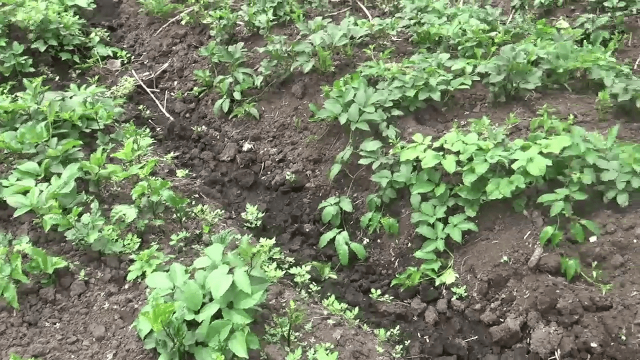
Agriculture and Environment
The use of GIS in agriculture approaches can be traced to the need to measure the area of land resources, to reclassify and dissolve prior to display, and to overlay data sets and to compare them spatially. These remain among the most basic justifications for GIS technology. GIS technology is of considerable interest in land management, particularly of national parks and other federal, state and provincial lands, and has been adopted in many countries.
In agriculture, the main issue arises from the critical importance in farming of changes over time and season. Although much research has been conducted on the interpretation of agricultural data from remotely-sensed imagery, there remain the conceptual problems of classification and interpretation. Marine environmental monitoring and climatology are good examples.
The use of geographic information systems and GPS is primarily in the production of exactness agriculture. Exactness agriculture is a catch-all expression that describes using technologies of geographic information systems and GPS to manage specific field areas. Technologies of exactness agriculture use information from various sources to aid farmers in decisions making about crop production and management based on the variability of the potential of production inside fields
SOURCES AND REFERENCES
Application of Geographical Information Systems by J. V. Iyengar (Jackson State University)
Uses and Applications of Geographic Information Systems by Ahmed Kareem Jebur (Department of Surveying Techniques, Kut Technical Institute, Middle Technical University, AL-Kut, Iraq)
Introduction to Remote Sensing and Geographical Information Systems by Ulrik Mårtensson (Department of Physical Geography and Ecosystems Sciences Lund University)


Share This Article: